Published December 24, 2018
| Version v0.2
Dataset
Open
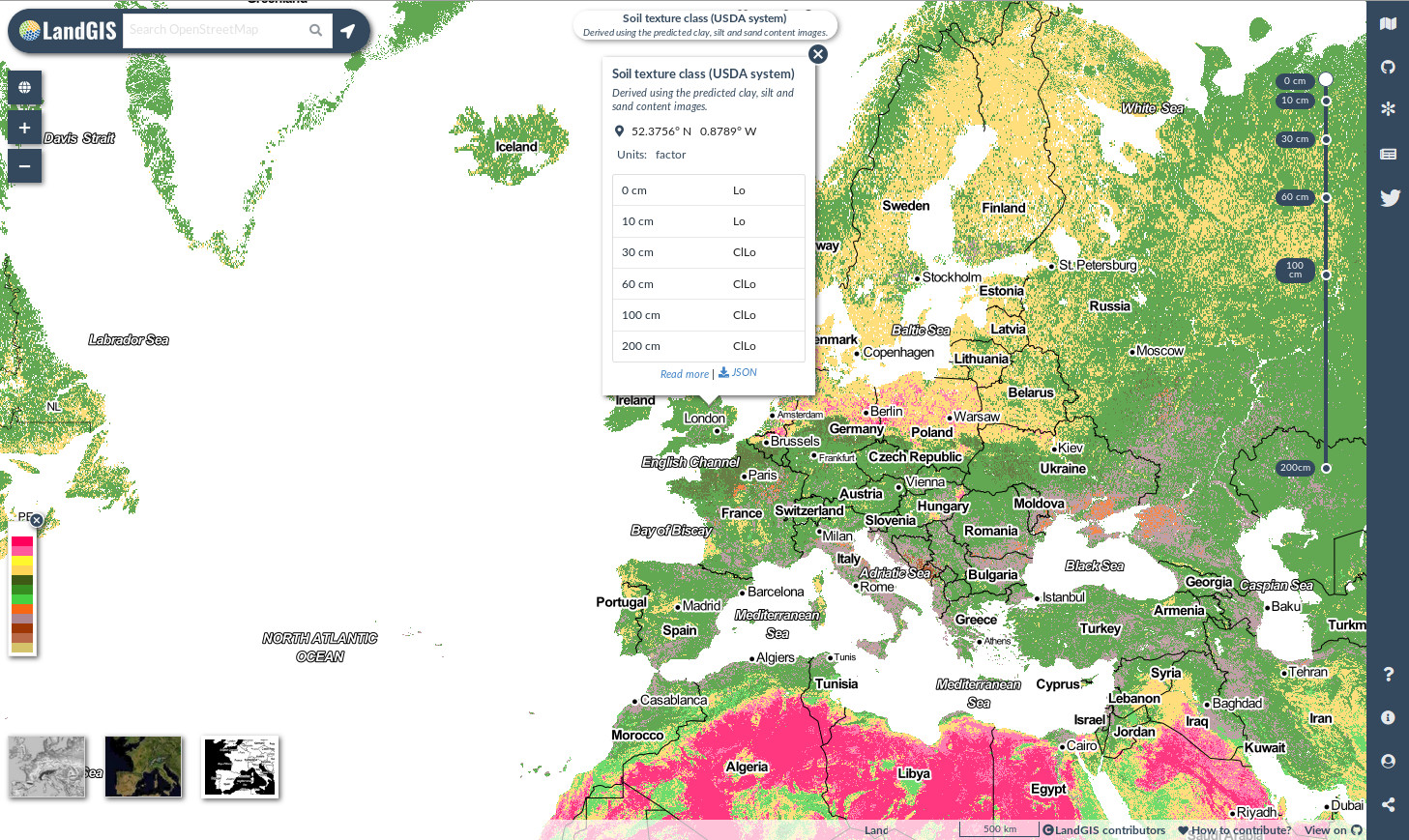
Soil texture classes (USDA system) for 6 soil depths (0, 10, 30, 60, 100 and 200 cm) at 250 m

Description
Soil texture classes (USDA system) for 6 standard soil depths (0, 10, 30, 60, 100 and 200 cm) at 250 m. Derived from predicted soil texture fractions using the soiltexture package in R. Processing steps are described in detail here. Antartica is not included.
To access and visualize maps use: OpenLandMap.org
If you discover a bug, artifact or inconsistency in the maps, or if you have a question please use some of the following channels:
- Technical issues and questions about the code: https://gitlab.com/openlandmap/global-layers/issues
- General questions and comments: https://disqus.com/home/forums/landgis/
All files internally compressed using "COMPRESS=DEFLATE" creation option in GDAL. File naming convention:
- sol = theme: soil,
- texture.class = variable: soil texture class,
- usda = determination method: USDA texture triangle,
- c = factor,
- 250m = spatial resolution / block support: 250 m,
- b10..10cm = vertical reference: 10 cm depth below surface,
- 1950..2017 = time reference: period 1950-2017,
- v0.2 = version number: 0.2,
Files
landGIS_soil_texture_class.jpg
Files
(2.8 GB)
| Name | Size | Download all |
|---|---|---|
|
md5:5c8f6e62181baffb0a542120b22a1aa9
|
659.9 kB | Preview Download |
|
md5:772831201f355738b180e9cf94bd6b62
|
2.1 kB | Download |
|
md5:4248e161b83370f0b07b41f4d5e0acd7
|
437.3 MB | Preview Download |
|
md5:50b88e39ef2eab8cd653b7dadaf73232
|
442.7 MB | Preview Download |
|
md5:cbbb106d5324fefa15a579c0b138828d
|
483.5 MB | Preview Download |
|
md5:47b733a31a12e81ec371a3780f91a1bd
|
484.0 MB | Preview Download |
|
md5:43a319b6019daed78dce469653f82510
|
455.3 MB | Preview Download |
|
md5:2a4524fbb899b14188091f39ad1ca387
|
477.9 MB | Preview Download |
|
md5:dad356800be2a2833cdd0ae2045f5642
|
349 Bytes | Preview Download |
Additional details
References
- Moeys, J., & Shangguan, W. (2015). soiltexture: functions for soil texture plot, classification and transformation. R package version 1.3. 3.
- Hengl, T., MacMillan, R.A., (2019). Predictive Soil Mapping with R. OpenGeoHub foundation, Wageningen, the Netherlands, 370 pages, www.soilmapper.org, ISBN: 978-0-359-30635-0.